
Research Facility/Centre | UAV Photogrammetry and Scanning Drones
Institution:
![]() Location:
Location:
St. John's
- Hyspex Mjolnor: Hyperspectral imaging sensor with short-wave infrared (SWIR) and very near infrared wave (VNIR) cameras to collect aerial images. Also has a LiDAR (Light Detection and Ranging) attachment to map the 3D surface. Comes with a tripod mount for non-aerial use.
- Astralite Edge: Combination topometric and bathymetric sensor used to create a 3D map of ground and underneath shallow (up to 6m) water. This sensor is mounted on an Uncrewed Aerial Vehicle (UAV).
- Flyability Elios 3: Rotary wing inspection Uncrewed Aerial Vehicle (UAV) with RGB (red, green, blue) camera, LiDAR (Light Detection and Ranging) puck, and thermal camera. Protected inside a cage to prevent damage to the system in hazardous or small spaces. Designed to work both above and below ground in GPS denied areas.
- Hercules 8: Multi-purpose industrial lift Uncrewed Aerial Vehicle (UAV), designed to hold the Hyspex Mjolnir sensor to collect hyperspectral imagery aerially.
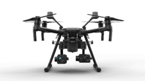
- DJI Matrice 600 Pro: Multi-purpose rotary wing UAV used to mount a variety of sensors, namely the Zenmuse X5 camera, GeoSLAM Zeb Horizon, and the AstraLiTE EDGE.
- DJI Phantom 4 RTK: Photogrammetry rotary wing Uncrewed Aerial Vehicle (UAV) with Real-time kinematic (RTK) positioning capabilities to allow aerial imagery to be collected without ground control targets placed on site.