Research Facility/Centre | Reality Capture Instruments
Institution:
![]() Location:
Location:
St. John's
- Geoslam: Handheld mobile Simultaneous Localization and Mapping (SLAM) LiDAR (Light Detection and Ranging) unit used to create 3D maps of an area or structure, with a range of platforms and accessories.
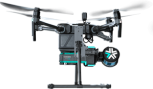
- ExynAero: Autonomous (Level 4) Simultaneous Localization and Mapping (SLAM) LiDAR (Light Detection and Ranging) Uncrewed Aerial Vehicle (UAV) used for 3D mapping high-risk, GPS denied environments.
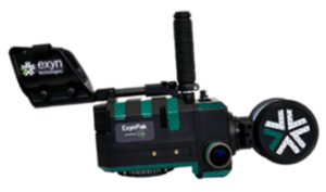
- ExynPak: Handheld mobile Simultaneous Localization and Mapping (SLAM) LiDAR (Light Detection and Ranging) unit used to create 3D maps of an area or structure.
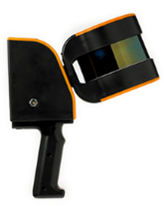
- HandySCAN 3D –Black Elite: Portable handheld ultra-high definition metrology grade scanner to an accuracy of 0.025 mm with applications ranging from reverse engineering to high-precision surface monitoring.
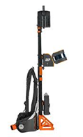
- ZEB Discovery: The ZEB Discovery synchronises data from the ZEB Horizon LiDAR sensor with a high-resolution camera for rapid urban mapping. Includes ZEB Pano to automatically and accurately position panoramic photos and create 2D and 3D property floorplans and the ZEB Car Mount allows the ZEB Horizon to be mounted on a vehicle.
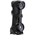
- Leica BLK 360 G2: Small terrestrial LiDAR (Light Detection and Ranging) system with integrated high-speed high dynamic range (HDR) spherical imaging systems and Visual Inertial System (VIS) for real-time pre-registration, used to create precise, photorealistic 3D models of an area or structure.
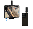
- Vidoc RTK Rover: Global navigation satellite system (GNSS) attachment for the iPad Pro to get more accurate location information and produce accurate 3D models from terrestrial photogrammetry.